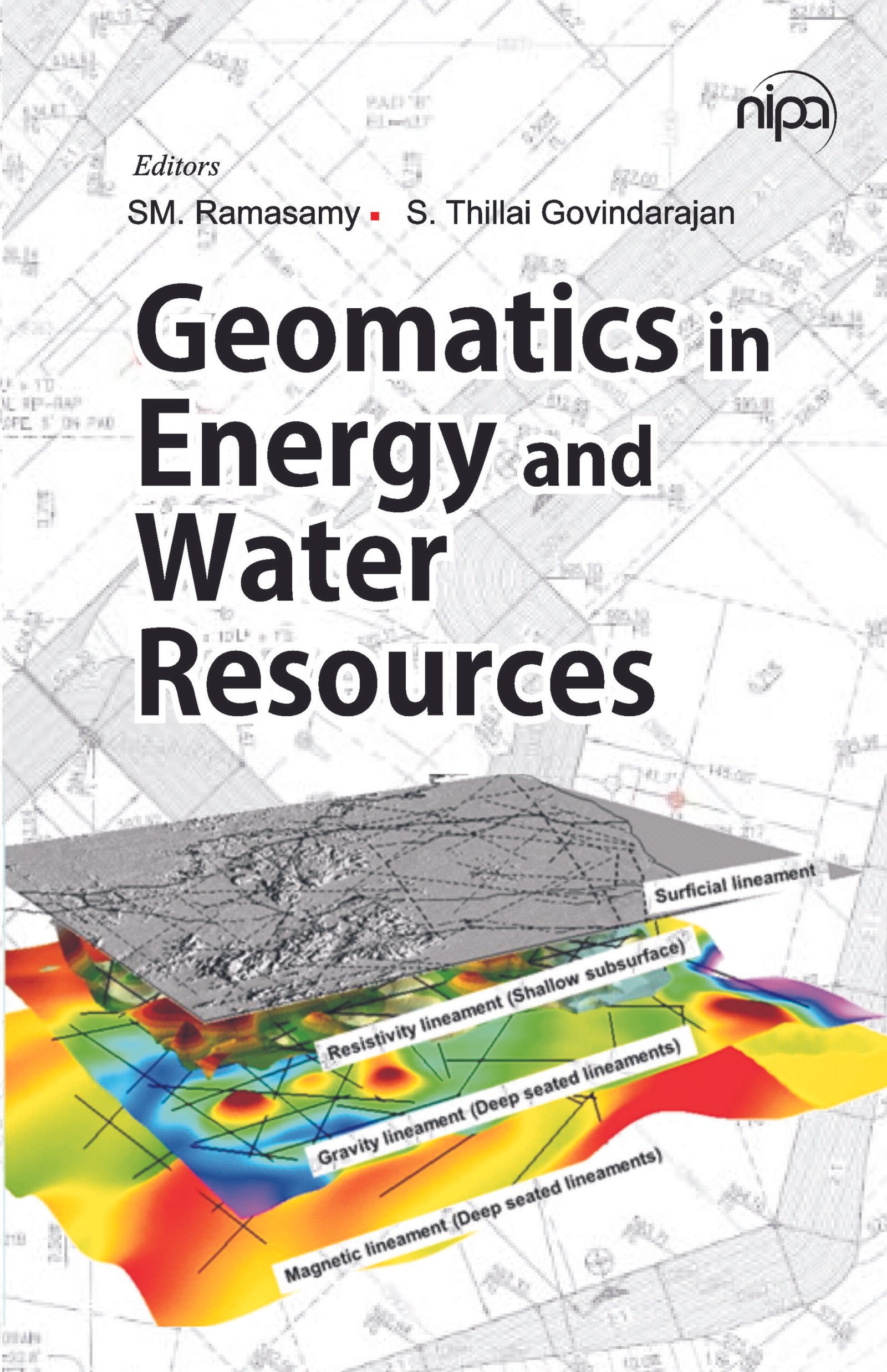
| Due to the rapid growth in population, the depletion of non-renewable and water resources has become a pressing issue. To address this problem, geoscientists and technocrats have undertaken extensive research initiatives to locate new reservoirs of these resources and develop sustainable models for their conservation. These efforts require a comprehensive understanding of rock types, tectonic architecture, geomorphology, and reservoir conditions. Geomatics technology, including remote sensing and geographic information systems, has proven to be indispensable tools in managing and inventorying these resources. Remote sensing provides synoptic, multispectral, and repeatable data, while GIS enables the storage, manipulation, and modeling of vast amounts of spatial and non-spatial data. Geologists and researchers employ diverse concepts and methods, such as 3D visualization of subsurface lineaments, SRTM-based lineament mapping, spatio-linear modeling of hard rock aquifer systems, and 3D visualization of oil-bearing structures, to study divergent geological provinces and processes in both field and research settings. |
Sale
| author | SM. Ramasamy & S.Thillai Govindarajan |
|---|---|
| publisher | nipa |
| language | English |
| pages | 284 |
Bestsellers

Sale

Sale

Sale
Sale

Sale
Sale
Sale